Showing posts with label SFMTA. Show all posts

Wednesday, July 13, 2022

Permanent Adaptive Cycling Program Unveiled in Golden Gate Park

Permanent Adaptive Cycling Program Unveiled in Golden Gate Park
By Maddy Ruvolo

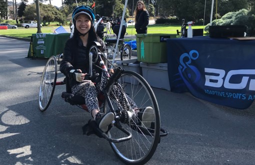
A woman sits on an adaptive recumbent bike in Golden Gate Park; a sign for BORP is in the background.

As adaptive bikeshare enthusiasts know, cycling isn’t only for people who are able-bodied. On Saturday, a permanent adaptive cycling program that will serve Golden Gate Park and the Great Highway launched in partnership with San Francisco Recreation & Parks and the Bay Area Outreach and Recreation Program, commonly known as BORP.

The free program matches people with disabilities to adaptive bicycles by advance reservation. The BORP Cycling Center hosts one of the largest collections of adaptive bikes in the world, including handcycles, recumbent bikes, side-by-side tandems, and other models. The program serves children, youth, and adults with physical and sensory disabilities, as well as their family and friends.

The Adaptive Cycling Program will run on Saturdays from 1 to 4 p.m. by appointment only from April through October. Locations will alternate between the Music Concourse in Golden Gate Park next to the new accessible bandshell lot and the Great Highway at Judah Street. To reserve a bike, contact the BORP Cycling Center at 510.848.2930 or cycling@borp.org.

In 2021, the SFMTA and Rec and Park ran a pilot adaptive bikeshare program for people with a broad range of disabilities in Golden Gate Park. The program was held in partnership with the Metropolitan Transportation Commission and Bay Wheels/Lyft. The SFMTA is currently conducting a formal evaluation of the pilot program, but early results tell a clear story: adaptive cycling is a fun and exhilarating option for exercise and recreation.

In both the pilot and new program, BORP staff fit participants to adaptive bikes and help them transfer from their mobility devices when necessary. The pilot program was very popular among participants: survey respondents rated the program 4.76 out of 5 stars and encouraged the City to permanently adopt an adaptive cycling program. Participants shared that the program was a good family outing, with one person coming for the first time on her birthday. Another noted that the program provided a fun and useful way to complete their physical therapy exercises. Seventy-eight percent of participants were first-time adaptive bikeshare riders, and the vast majority of participants surveyed (94%) said they would like to use bikeshare more frequently in the future. The program was popular across age groups: participants had an average age of 38, ranging from 14 to 82 years old.

Reflecting what participants told us they wanted, the new program is near transit, accessible bathrooms and parking, and safe, car-free spaces.

The SFMTA is thrilled to partner with Recreation & Parks and BORP in rolling out a permanent adaptive bike program, and we are also interested in hearing feedback from San Francisco residents and visitors who have not yet had a chance to try out adaptive cycling. If you are an older adult or have disabilities, we want to hear from you! Please help shape the future of adaptive biking in San Francisco by taking our follow-up survey.


Published July 13, 2022 at 10:57PM
https://ift.tt/eXdDFNM

Wednesday, June 29, 2022

The Lasting Legacy of the 1913 Bion Arnold Report

The Lasting Legacy of the 1913 Bion Arnold Report
By Jeremy Menzies

Looking back at San Francisco’s transportation history, one study from 1913 has impacted the city’s transit system for over 100 years. Commissioned by city officials, the “Report on the Improvement and Development of the Transportation Facilities of San Francisco” by engineer Bion J. Arnold, is a comprehensive study of transit in the city. The 450-page report covers everything from rush hour congestion to plans for a Market Street subway. This document is essential to understanding our city’s transportation history and some of its recommendations are still in use today.

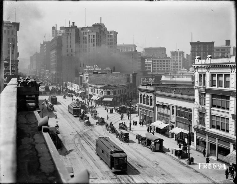
Black and white overhead view of street with horse-drawn and electric streetcars, horse drawn wagons, pedestrians, and buildings. Business signage includes Patrick and Company and Fly Trap.

This 1910 view of Market and Sutter streets shows just some of the complex issues that the Arnold report addressed.


Building Muni

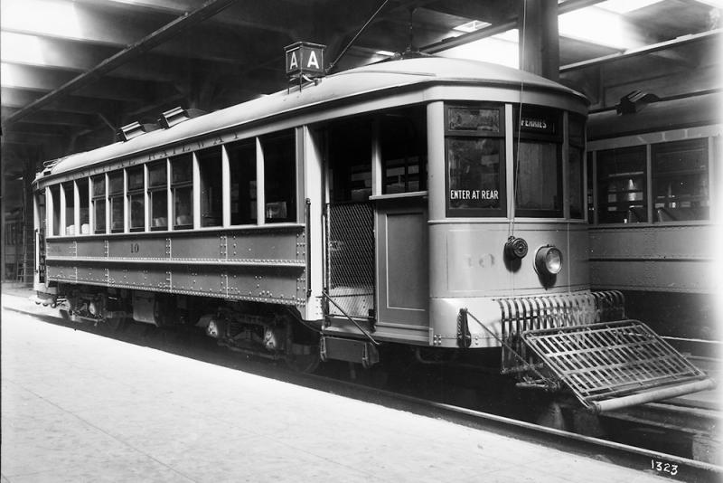
One section of the report is entirely dedicated to specifications for building and improving the city’s cable and street cars. Muni’s very first streetcars, frequently called “Arnold” cars, were specified based on construction cost, passenger comfort, ease of operation, and even the unique climate of San Francisco. Today, historic Streetcar 1 is one of these streetcars that still runs in special service.

front and side view of old-style streetcar. Route reads "A". Headsign reads "Ferries". Sign reads "Enter at rear". Car is branded "Municipal Railway".

This photo of one of Muni’s first streetcars was used on page 178 of the report and shows the open end sections, boarding platforms, and “automatic” ventilation features specified by Arnold.

In addition to the vehicles, Muni’s earliest lines, and service to the 1915 Panama Pacific Exposition, were all directly influenced by the report. Versions of the A, B, C, E, F and H streetcar lines all appear in the report. It also influenced later lines like the J, K, L, and M.

group of people walking away from streetcar. car is headsigned "Exposition".

Passengers alight from a Muni streetcar at the 1915 world’s fair. Arnold dedicated an entire section of the report to discussing service to the fair, which was provided by Muni and the United Railroads Co.


Tunnels & Streets

The report also detailed several tunnels and street changes throughout the city meant to speed travel across town. Of the more than ten tunneling projects proposed, the Stockton Street, Twin Peaks, and Sunset tunnels were all built by 1930. The Broadway tunnel followed in the early 1950s.

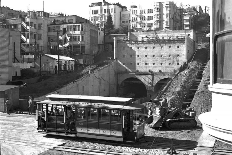
cable car in foreground with excavation, bulldozer, and tunnel entrance in background. car is branded "Municipal Railway" and signed "Powell and Mason streets".

A cable car on Mason Street passes by the Broadway Tunnel, still under construction in this 1951 shot.


Among the street changes proposed, the extension of Market Street over Twin Peaks was perhaps the largest. This extension was built alongside the Twin Peaks Tunnel in 1917-18.

Improving and Expanding Transit

Arnold also called for a consolidated transit system and a subway under Market Street, both of which were achieved by the mid-20th Century.  In 1944, voters approved the purchase of the Market Street Railway Company, the largest transit operator in SF. This merger unified public transit service under Muni. Instead of navigating two competing services, riders finally had a one-fare ride to virtually anywhere in town. Consolidation also allowed improvements to be made across the system.

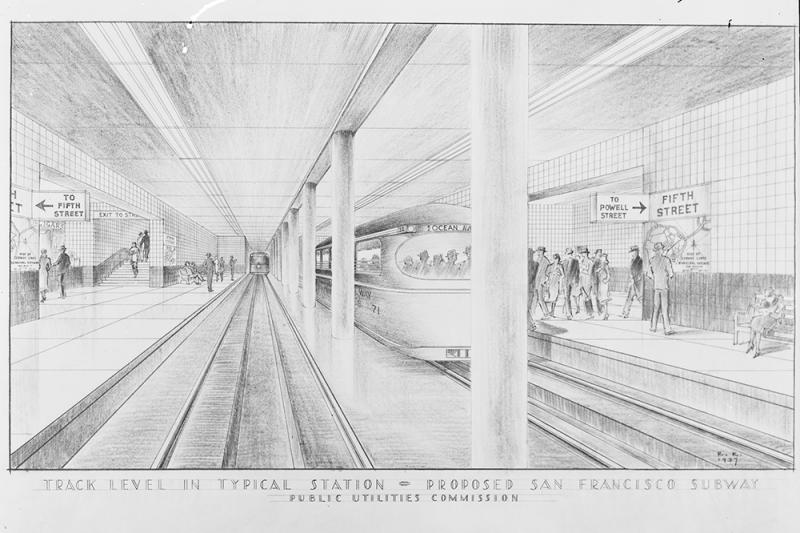
Drawing of subway station showing streetcars, platforms, signage, people and tracks. Drawing is titled "Track level in typical station. Proposed San Francisco subway. Public Utilities Commission." Signs in drawing read "Fifth Street" as station name, directional signs reading "To 5th Street", "Exit to 5th", "To Powell Street". Streetcar headsign reads "Ocean Avenue".

Bion Arnold’s Market Street subway plans were just one of many ideas floated over the years. This drawing from 1937 shows a proposed subway station at Powell and Market streets.


Arnold’s report is one of the earliest documents to include clear plans for a Market Street subway. 50 years later when Bay Area voters approved general obligation bonds to build BART & Muni Metro, elements of Arnold’s subway showed up in the design.

Ongoing Legacy

Even today, suggestions from the report can be found in the SFMTA’s Muni Forward and Vision Zero Quick Build programs. Moving and consolidating stops, increasing boarding area size, building transit boarding islands, and all-door boarding are all mentioned in the 1913 document.

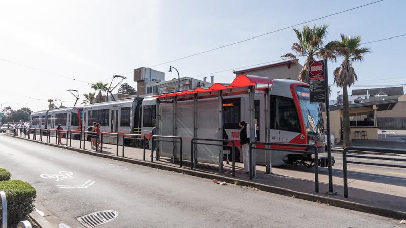
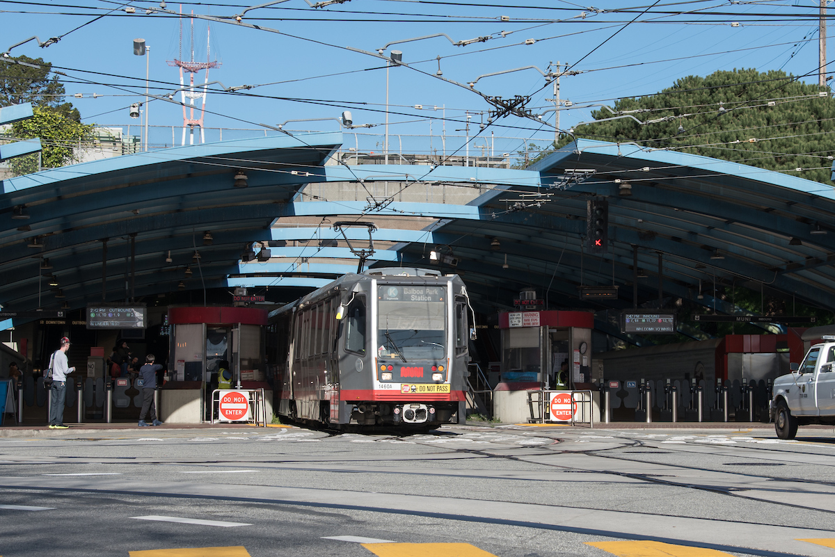
street-level transit platform with train and people waiting

A common sight today, double-length platforms and two-car trains like those pictured here were just two improvements to transit service recommended by the Arnold report.

The Arnold report is one of the most extensive studies of transportation in San Francisco. 109 years later, many of the changes recommended by the report have become normal parts of our streets and transit system.


Published June 29, 2022 at 10:59PM
https://ift.tt/uKT4QhD

Tuesday, June 21, 2022

What’s next after the loss of Prop A?

What’s next after the loss of Prop A?
By Andrea Buffa

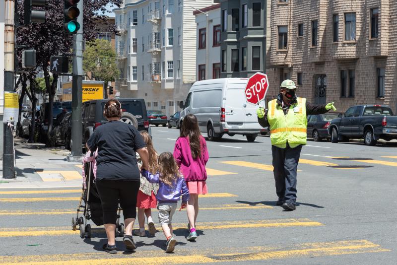
School Crossing Guard James Moore at Sherman Elementary School on Franklin Street. May 2022

On Tuesday, June 17, the San Francisco Department of Election posted the final results of the June 7 election. Proposition A, the Muni Reliability and Street Safety Bond, received 65.11%, well over 50%, but short of the 66.67% share of the vote that’s required for passage. 

If passed, the bond measure would have provided $400 million for transportation infrastructure projects, including:

  • $250 million on the repair and renovation of SFMTA bus yards, facilities, and equipment
  • $26 million on traffic improvements, such as new traffic signals, wider sidewalks at bus stops and dedicated traffic lanes
  • $10 million on improvements to the Muni train system, including the train communication and control systems
  • $42 million on traffic signal and street crossing improvements, such as more visible traffic and pedestrian signals, curb ramps and signs
  • $42 million on street redesigns that include wider sidewalks, raised crosswalks, protected bike lanes, bus lanes, boarding islands and better lighting
  • $30 million on projects to manage traffic speeds, including lowered speed limits and speed radar signs

Although an overwhelming majority of voters supported investing in our transportation system, getting to the two-thirds threshold for a bond measure is never easy—more so when San Francisco is still recovering from the COVID-19 pandemic and people are struggling with the impacts of inflation.

The loss of Proposition A will have a cascading impact on San Francisco’s transportation projects. In the coming weeks, we’ll be evaluating the impacts of this result to transit and safety projects across the city. We don’t yet know which specific projects will be impacted, but we do know that every step toward getting the city’s transportation capital projects done is going to be harder than it would have been if the bond measure had passed.

The SFMTA is going to do everything possible to find alternative sources for these funds. We know that improving Muni and making streets safer remain priorities for our community—and we’re committed to working to make that a reality. 

The loss of Proposition A is going to make our path to transitioning to a 100% zero emission fleet more difficult, because a large amount of funding was going to go toward upgrading Muni facilities so we can charge battery-electric buses in them. It’s also going to make it harder to fund the street improvements on San Francisco’s high-injury network that are crucial to preventing traffic deaths and serious injuries.

These challenges don’t just impact people who ride Muni, walk or bike to get around. They impact drivers. When more people take transit, bike and walk, it reduces congestion for people who need to travel by car.

As we plan our next steps, we’ll be looking at what we can learn from the election results and how we can apply those lessons moving forward. We need to have more conversations and engagement with community members and community-based organizations—especially those on the west side of the city, where support for the bond measure was lowest—to ensure that we fully understand their transportation needs. We also need to continue building trust with San Franciscans so we can work together to create a robust transportation network that equitably connects everyone to where they need to go, regardless of their income or neighborhood.


Published June 21, 2022 at 10:43PM
https://ift.tt/h2zLHbq

Wednesday, October 27, 2021

Vaccine-Related Service Changes Go into Effect November 1

Vaccine-Related Service Changes Go into Effect November 1
By Mariana Maguire

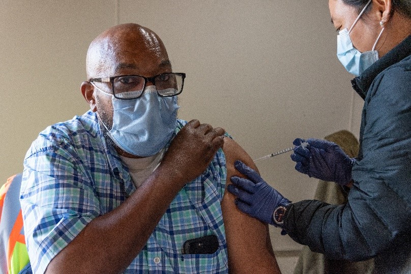
Photo shows a man receiving a vaccination.

An SFMTA staff person receives the COVID-19 vaccine at the Woods Muni Maintenance Division

To address operator shortages due to the city’s mandate that only vaccinated employees may work after November 1, the SFMTA will temporarily suspend “short” line service on a few Muni lines. Short service refers to buses that run on a segment of a longer Muni route to help improve frequency on higher-ridership portions of the line. The long routes on these lines will continue to operate, connecting customers where they need to go. There will be no cancellation of any Muni routes in response to staffing challenges associated with the city’s vaccine mandate.

Starting November 1, we are planning to temporarily suspend the 1 California Short, 14R Mission Rapid Short (weekends only), 30 Stockton Short, and 49 Van Ness Short (on weekdays only).  These changes are intended to reduce impacts to service systemwide, but customers may experience additional crowding and longer wait times on various bus routes as a result. These changes may impact also NextMuni predictions.

Why These Routes

We made the difficult decision to cut the supplemental short line service because it may be temporarily eliminated without jeopardizing access to any stops or connections along the full route. Based on feedback we received from the public regarding service planning for early 2022, we heard that priorities include preserving and restoring connections and service in hilly areas, as well as ensuring ongoing access for people with disabilities and seniors. Temporarily suspending short service allows us to meet these needs while we work to put additional staff in place.

Next Steps

Currently, we don’t have a precise timeline for when we will be able to restore additional service or increase frequencies on these short routes. However, we continue to work with our operators to address their vaccination status so that they can return to work as quickly as possible. We are also hiring and training new operators.

We are moving forward with additional Muni service in early 2022, pending approval by the SFMTA Board of Directors on December 7. At the same time, we will continue to adjust operations in response to  operator availability.

We appreciate your patience as we work to address the vaccination mandate. We will keep customers and the public updated. For the latest, please follow us on Twitter @sfmta_muni or Facebook.


Published October 27, 2021 at 10:41PM
https://ift.tt/3nDQFi6

Friday, September 17, 2021

SFMTA Resumes Peak Hour Tow-Away Zone Enforcement

SFMTA Resumes Peak Hour Tow-Away Zone Enforcement
By Jessie Liang

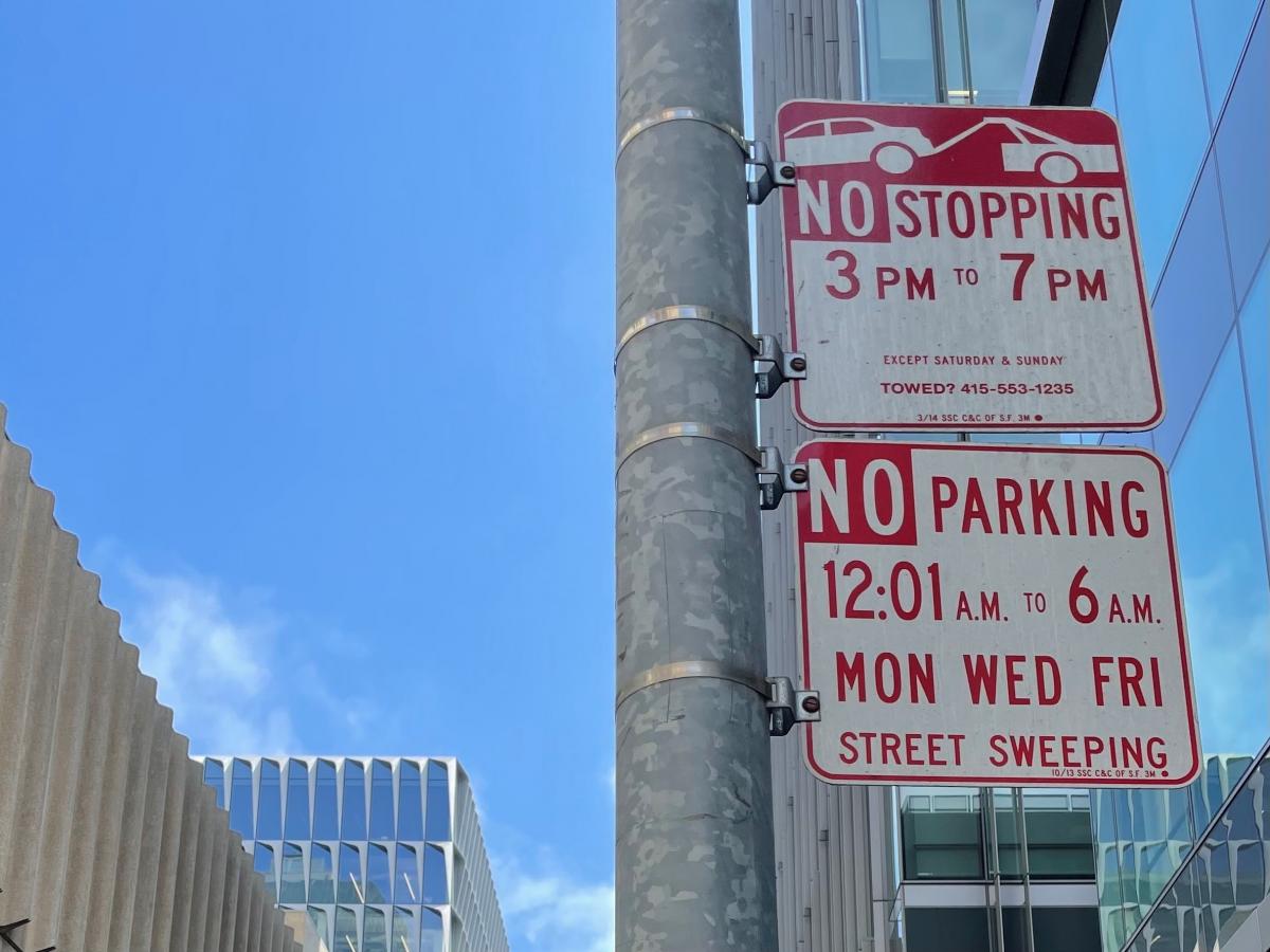
sign showing no stopping 3-7 pm

The SFMTA’s towing programs were temporarily suspended in March 2020 in response to the COVID-19 pandemic. As the city has reopened and traffic has returned, the SFMTA will resume enforcement of peak hour commuter tow-away zones starting September 20.

Vehicles parked at tow-away zones during restricted peak hours will be subject to citation and towing. 

We’re bringing back the enforcement of peak hour tow-away zones under the SFMTA Transportation Recovery Plan (TRP) as the economy reopens. Tows help the SFMTA facilitate the flow and safety of transit and traffic, support economic activity and maintain safe streets.

The reinstated tow-away enforcement will accommodate changing conditions on city streets. For example, enforcement will not apply to Shared Spaces that allow merchants to use sidewalks, full or partial streets and other nearby outdoor spaces under San Francisco’s Public Health Orders.

In addition to tows at peak hour tow-away zones, towing for all other violations will continue. These include but are not limited to, tows for violations of 72-hour overtime parking limits, vehicles with expired registrations over six months and vehicles with five or more delinquent parking citations.


For more information, please visit the Parking and Driving section of SFMTA’s COVID-19 Developments & Response.


Published September 17, 2021 at 09:34AM
https://ift.tt/39ft0Ow

Wednesday, July 21, 2021

South Van Ness and Mission Intersection Closure August 4-9

South Van Ness and Mission Intersection Closure August 4-9
By John Gravener

With the recent completion of the new red transit lanes along Van Ness Avenue, the Van Ness Improvement Project is now focused on its upcoming Mission Street closure as the project works to complete construction later this year. 

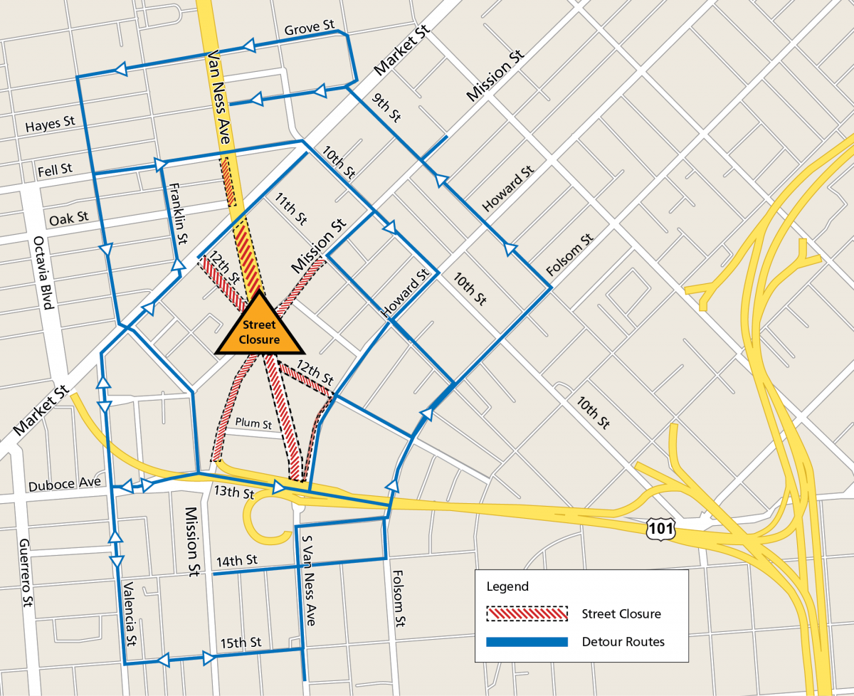
The major intersection closure, scheduled for August 4-9, is planned to reduce the duration of the work there. By closing the full intersection for five days, the team can complete work in the intersection that would normally require two months of work completed one segment at a time. The goal is to minimize inconvenience for the public.

Map of Van Ness Avenue and Mission Street intersection showing detours and street closures. Streets closed to traffic include South Van Ness Avenue south of Market, Mission Street one block west of 11th Street, 12th Street north of Howard, South Van Ness north of Highway 101, Highway 101/Mission Street highway exit, and 12th Street south of Market will all be closed to traffic. Detour streets include Howard Street, Folsom Street, 10th Street, 9th Street, 13th Street, Duboce Avenue, Gough Street, Franklin Street, Fell Street, Hayes Street and Grove Street can all help you avoid the closed intersection.Map of Van Ness Avenue and Mission Street intersection with reroutes.

Once the construction during the intersection closure has been completed, there will be just a few more milestones left for the Van Ness Improvement Project before construction wraps up later this year. New overhead powerlines for transit lines will be installed. Additionally, crews will begin installing landscaping and irrigation systems, as well as pedestrian bulb-outs on sidewalks to aid in safer crossings for people walking.  

The project website details the available reroutes and provides additional information for motorists. While pedestrian access will be maintained at all times, people walking should consider bypassing the area. Transit will be rerouted, with Muni and AC Transit bus stops relocated and highly visible signage posted. Muni Metro and BART service will not be affected.

Once construction is complete, San Francisco’s first Bus Rapid Transit (BRT) system, a much needed and globally proven solution to improve transit service and address traffic congestion on Van Ness, is expected to begin operation in early 2022.   

In addition to the building of the BRT, the multi-agency Van Ness Improvement Project has also included the replacement of 1800s-era water main to better withstand a major earthquake, new streetlights that are more power-efficient and brighter, installation of the overhead contact system that provides 100% emissions-free hydroelectric power from Hetch Hetchy—the city's municipal power source—to power the buses, new landscape to beautify the corridor, and new pavement on Van Ness for smoother travel and sidewalk extensions for a safer experience for people walking. Completion of the project is in sight, with construction projected to finish by the end of the year.

The August 4-9 closure will impact people driving, biking, taking transit and walking in SoMa, Tenderloin, Civic Center, Hayes Valley, Downtown and Inner Mission. The South Van Ness and Mission Street intersection will be closed at all times, as well as the roads leading to the intersection. People who travel in the area are encouraged to “Scout Your Route” before the shutdown and plan their travel accordingly.

Thank you to all the residents and travelers who have remained patient through the traffic reroutes, dust and noise! We appreciate your support and are excited to welcome you on to the new BRT in early 2022. 


Published July 22, 2021 at 12:32AM
https://ift.tt/3wUq8j9

Friday, July 2, 2021

Beat the traffic and celebrate July 4th with Muni! 

Beat the traffic and celebrate July 4th with Muni! 
By Jonathan Streeter

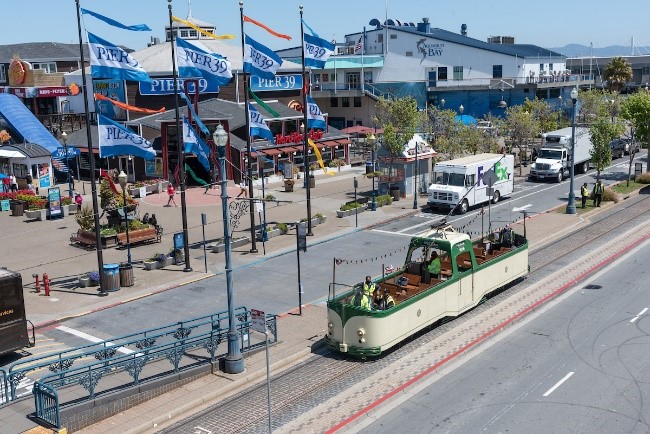
Photo of Pier 39 with historic "boat car" streetcar

The Fourth of July fireworks are back this year, thanks to COVID-19 vaccines and the city’s ongoing reopening! The show will start at 9:30pm over San Francisco’s historic waterfront.

Muni wants to get you to the festivities and back, quickly and safely, on Independence Day. The State of California strongly recommends that anyone planning to attend the Fourth of July fireworks be fully vaccinated, obtain a negative COVID-19 test prior to attending the event, or wear a face covering. Customers must wear face masks while riding transit or using transit facilities, per federal mandate.

Getting There

Before the show, from 3 to 9 p.m., Muni will provide extra service to connect people from the Muni Metro Subway, BART, Ferries and Caltrain to the fireworks viewing area. Along the Embarcadero, Muni will have two shuttle routes to Pier 39.

  • From the Ferry Building, board at Steuart & Mission and at historic streetcar stops along the Embarcadero.
  • From the Caltrain Depot, board at the 47 stop on Townsend Street west of 4th Street and from the Ferry Terminal onward, board at historic streetcar stops along the Embarcadero.

Getting Back

After the show, from 9 to 11:30 p.m., Muni will have two express shuttles providing express service from Pier 39 to the Ferry Building and Caltrain. These buses will use transit-only lanes to avoid traffic wherever possible.

For details, please visit our Fourth of July extra service webpage.


Published July 02, 2021 at 10:24AM
https://ift.tt/3xgjuEZ

Tuesday, May 4, 2021

Join Us in Transforming Evans Avenue

Join Us in Transforming Evans Avenue
By Adrienne Heim

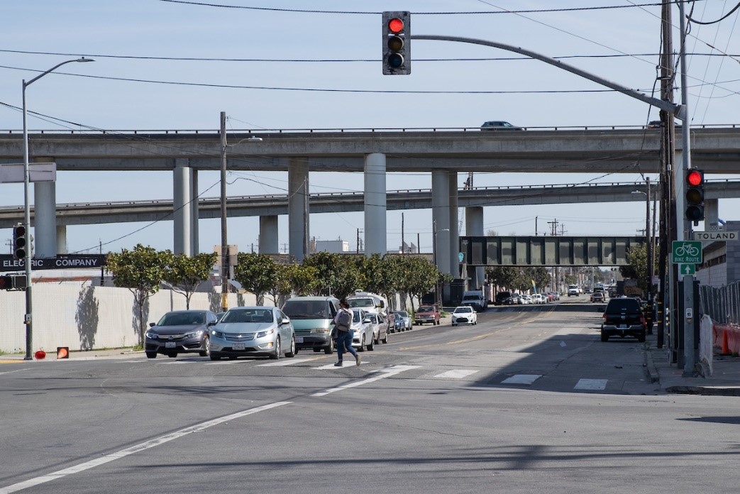
Photo of Person walking across Evans Avenue at Napoleon Street

Pedestrian crossing Evans Avenue at Napoleon Street

This month we are reaching out to community groups and businesses along Evans Avenue for feedback on making this corridor safer and more inviting for everyone, by means of a Quick-Build project.

 Entering Evans Avenue from Cesar Chavez Street eastbound toward the Bayview-Hunters Point neighborhood, the street offers an unusual prospect for a corridor in San Francisco. Passing under freeway lanes and railway tracks, past industrial parks, retail and government buildings, the street eventually connects to Heron’s Head Park at Jennings Street.

Named after Robley D. Evans, a Commander in the U.S. Navy from 1864-1908, Evans Avenue served as one of three vital routes into the Hunters Point Naval Shipyard when it was operating from 1940 to 1974. Between Cesar Chavez and 3rd streets, the roadway consists of two travel lanes in both directions. The average traffic volume along this 0.7-mile stretch ranges from 12,000 vehicles per day (near 3rd Street) to 23,000 (near Cesar Chavez Street).  

Muni’s 19 Polk  serves Evans Avenue and connects to Muni lines including the T Third, 15 Bayview Hunters Point Express, 44 O'Shaughnessy and 91 3rd/19th Avenue Owl.

Why a Quick-Build project for Evans Avenue?

A quick-build project allows us to increase safety for all users of Evans Avenue by implementing relatively fast improvements with inexpensive treatments within months, such as: paint, traffic delineators, street signs and parking and loading adjustments. (See gallery below for examples of such treatments).

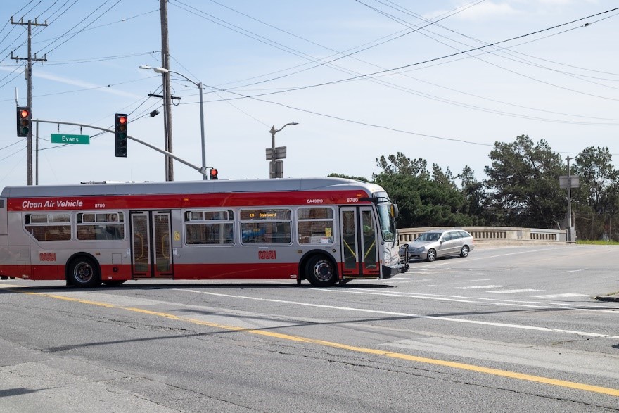
19 Polk turning off Cesar Chavez Street onto Evans Avenue

19 Polk turning off Cesar Chavez Street onto Evans Avenue

Evans Avenue is also a bike route, connecting bike lanes south of 3rd Street and on Cesar Chavez Street.

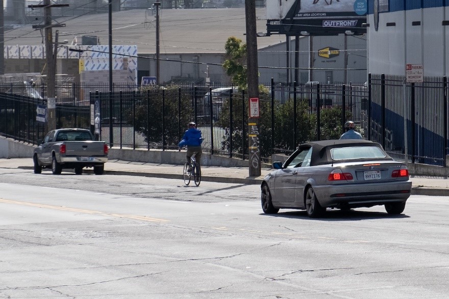
A person bicycling eastbound on Evans Avenue

A person riding a bicycle eastbound on Evans Avenue

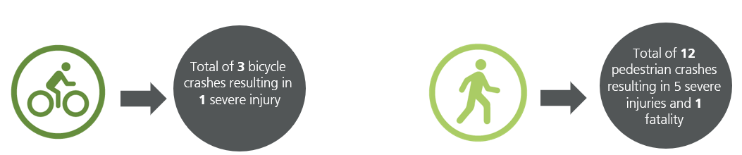
Evans Avenue is on San Francisco's Vision Zero High Injury Network, the 13% of San Francisco streets where 75% of the city’s traffic injuries and fatalities occur. From 2015 to 2020, 81 traffic collisions have been reported on Evans Avenue between Cesar Chavez and 3rd streets. This corridor is seeing rising traffic and the potential for conflicts due to ongoing and future development in the area.

image showing a total of 3 bicycle crashes resulting in 1 severe injury, total of 12 pedestrian crashes resulting in 5 severe injuries and 1 fatality


We have developed three design concepts to improve transportation safety along this stretch of Evans. Now, we want your feedback.

You can take our survey online or place your cell phone camera over the QR code.

QR code image

The survey will be open until May 21, 2021. 

We will analyze the feedback received from this survey and from direct outreach to local stakeholders before moving forward to the Engineering Public Hearing. After that, this project will be submitted to the SFMTA Board for review and approval. If given the green light, construction is expected to begin in fall 2021.

Learn more about the project and subscribe to project updates by visiting the Evans Avenue Quick-Build Project: Improving safety and access on Evans Avenue


Published May 04, 2021 at 08:11PM
https://ift.tt/3vEBzLO

Monday, April 19, 2021

Welcome Back to the Westside, K Ingleside Trains!

Welcome Back to the Westside, K Ingleside Trains!
By

Pre-pandemic photo of K Ingleside train exiting tunnel at West Portal

The K Ingleside exiting the subway at West Portal

On April 16, the SFMTA, along with Mayor Breed and District 7 Supervisor Myrna Melgar, announced that Muni’s K Ingleside trains will return to the westside starting May 15.

The return of these trains is happening much earlier than anticipated thanks to the hard work of SFMTA staff to find creative solutions to ramp up Muni service to riders and support the city’s economic recovery. 

“This addition of Muni service is a true testament to the collaboration between Muni staff, our labor unions and community partners,” said Julie Kirschbaum, SFMTA Director of Transit. “We know that key transit connections are critical to the city’s economic recovery, and we’re thrilled to re-open the subway and ramp up service.” 

The K Ingleside will join the previously-announced N Judah as part of Muni Metro’s reopening, highlighting the agency’s commitment to maximizing transit access citywide. Recent subway repairs enable the K Ingleside to be interlined with the T Third line and run through a much more reliable subway system.

The pandemic enabled us to accelerate other upgrades and necessary maintenance work, provided by a rare, extended subway shutdown. These are part of the Subway Renewal Program, a systematic approach to upgrades over the next 10 years that addresses both longstanding issues predating the pandemic and other issues uncovered since the shelter-in-place began.

Key improvements include:

  • Wi-Fi availability for customers from routers installed in stations and cellular antennas installed in the tunnels
  • Installation of new wayfinding and directional signs at Castro and Church stations
  • Quicker and smoother trips as a result of overhead line enhancements and rail grinding

The return of K Ingleside rail service is only one part of a larger roll out of Muni Metro rail updates happening May 15:

K Ingleside/T Third 

K Ingleside and the T Third will once again be “interlined.” This means that the two routes will operate as one route, from Balboa Park to Sunnydale, providing subway service at all stations from Embarcadero to West Portal. 

 N Judah 

The N Judah is also returning to rail service. Riders will have more room and fewer pass ups, as the two-car train increases the N Judah’s capacity.

J Church, L Taraval and M Oceanview

These lines will all continue to operate as they currently do, though the increased capacity on the K/T trains will soon provide even better connections for those traveling downtown or to the western neighborhoods.  

  • The J Church will remain as a surface-only route from Duboce Avenue to Balboa Park
  • The L Taraval will operate with buses from the Zoo to Downtown 
  • The M Ocean View will operate with buses from Balboa Park to West Portal Station.


Published April 19, 2021 at 08:43PM
https://ift.tt/2RIMvJv

Muni Emergency Measures Point to Longer Term Transit Goals

Muni Emergency Measures Point to Longer Term Transit Goals
By
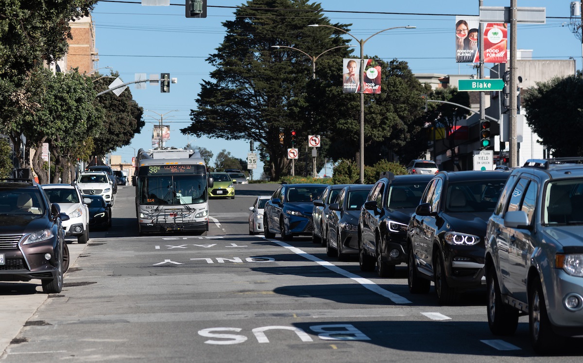
Photo of a bus driving in the 38 Geary Temporary Emergency Transit Lane with auto traffic in the adjoining lane

The 38 Geary Temporary Emergency Transit Lane

Muni is a core part of our community’s urban fabric that, like so much, has been upended by the pandemic. Yet, as hard as the last year has been, the SFMTA is focused on bringing Muni back better than ever. As we shift to focus on recovery, we’re looking closely at the emergency efforts we’ve implemented during the pandemic and how their proven effectiveness can help support San Francisco long-term.

This includes promising performance data from our Temporary Emergency Transit Lanes  program and plans for service restoration and future improvements. As part of an emergency response over six miles of temporary emergency transit lanes have been installed, benefitting tens of thousands of Muni customers each day, and helping to protect key Muni corridors from traffic. With the prioritization of temporary emergency transit lanes on routes that serve neighborhoods identified by the Muni Service Equity Strategy, the goal is to protect low-income and historically underserved people traveling on Muni from traffic congestion as the economy reopens and traffic returns.

Recent Muni Forward improvements are working: where we have invested in improvements like transit lanes, transit signal priority and bus bulbs, Muni customers are experiencing quicker and more reliable trips. When more people choose Muni because it’s fast and reliable, there are fewer cars on the street, reducing traffic congestion and greenhouse gas emissions.

Temporary Emergency Transit Lane Program Benefits Riders

Several transit lanes have already been in place long enough to collect substantive data, and the results are showing benefits to Muni riders. The success of these corridors - Geary, 4th Street Bridge, 7th and 8th Streets and Mission Street in SOMA – show how beneficial making investments in transit can be.

Here’s a quick run-down of each of their successes.

Mission Street (SOMA)

Mission Street in SOMA was our very first Temporary Emergency Transit Lane project and it is showing amazing results. The project took rush hour-only transit lanes and made them full-time. Here’s what we’ve learned:

  • Though traffic is 20% higher than in the summer of 2020, transit times are fairly consistent and only show a difference of 2 to 4% showing that bus travel times are being protected despite an increase in traffic
  • A public survey showed 65% of respondents support making the changes of the transit lanes permanent 

A 2-week online open house will be held Monday, April 19, through Monday, May 3, to inform the community of the outcome of the evaluation of the temporary project, and changes made based on feedback, prior to pursuing permanent legislation in June. For more information, visit SFMTA.com/TempLanes14.

Geary Boulevard (Richmond District)

Building upon the implementation of the Geary Rapid Project in the eastern half of the corridor, Geary Boulevard west of Stanyan is benefiting from new temporary emergency transit lanes, Muni head start signals and wooden bus bulbs. The data shows:. The data shows:

  • Muni speeds have stayed consistent or even increased despite increases in traffic
  • The biggest improvements have been for inbound 38R Geary Rapid passengers, whose trip got faster and more reliable across all times of day, with a 6% improvement in reliability in the morning rush hour commute

4th Street Bridge

T Third riders have long experienced delays near 4th and King Station – in front of Caltrain. New transit lanes on the 4th Street bridge, however, are showing real promise.

  • Transit delay at the 4th and Berry intersection has decreased by over 60%, and less than 1% of trains are impeded by auto traffic thanks to the new Temporary Emergency Transit Lanes
  • Trains are 2.5 times more likely to cross 4th and Berry, the intersection between the bridge and Caltrain, without stopping for a red light
  • When trains do wait for a green light, the average wait is 70% shorter

7th & 8th Streets

Serving the 19 Polk, much of 8th Street and a smaller slice of 7th Street received temporary emergency transit lanes early in the pandemic. In fact, the project has been so successful, we have rerouted the 27 Bryant over to 7th and 8th in SOMA to take advantage of the time savings and improve reliability for the entire line. On this corridor, we’re seeing:

  • 20% improvement in the 19 Polk’s on time performance despite a 35% increase in mixed traffic since April 2020
  • No recorded instances of crowding on the 19 Polk line, despite a 33% increase in ridership since the beginning of the pandemic, thanks in part to the headway reliability that the temporary emergency transit lanes support (reduced gaps and bunches that contribute to crowding)
  • Transit lanes have not caused traffic congestion to substantially deteriorate, demonstrating that transit benefits don’t need to negatively impact drivers

As the city reopens and traffic returns, temporary emergency transit lanes are being evaluated on their effectiveness with the goal of making the benefits of the temporary emergency lanes permanent.

Future Service Improvements

The benefits to Muni through the success of the temporary emergency transit lanes projects need to be protected. The success of the program is encouraging the SFMTA to pursue permanent changes along several of these corridors. Importantly, any long-term changes will incorporate public feedback to tweak the designs to better match emerging neighborhood needs. Making the Muni benefits we have seen through the Temporary Emergency Transit Lanes program permanent is one way that we can emerge from the pandemic stronger than before.

Legislation for permanent transit lanes on Geary and Mission Street in SoMa is under consideration.

In addition, two more temporary emergency transit lanes projects are being considered for approval by the SFMTA Board of directors today:

Finally, we’re taking advantage of the current environment to advance major construction projects that will deliver long-planned (and long-delayed) improvements.

These include:

All of these will add up to very real improvements for transit riders. If you want to learn more, check out this presentation prepared for the April 20, 2021 meeting of the SFMTA’s Board of Directors.


Published April 19, 2021 at 08:16PM
https://ift.tt/3apbWX8
Wednesday, April 7, 2021

The 150 Year History of Muni’s ‘Newest’ Route: The 15

The 150 Year History of Muni’s ‘Newest’ Route: The 15
By Jeremy Menzies

With the return of Muni’s 15 route earlier this year as the 15 Bayview Hunters Point Express, here’s a quick look back at a line that traces part of its lineage back over 150 years.

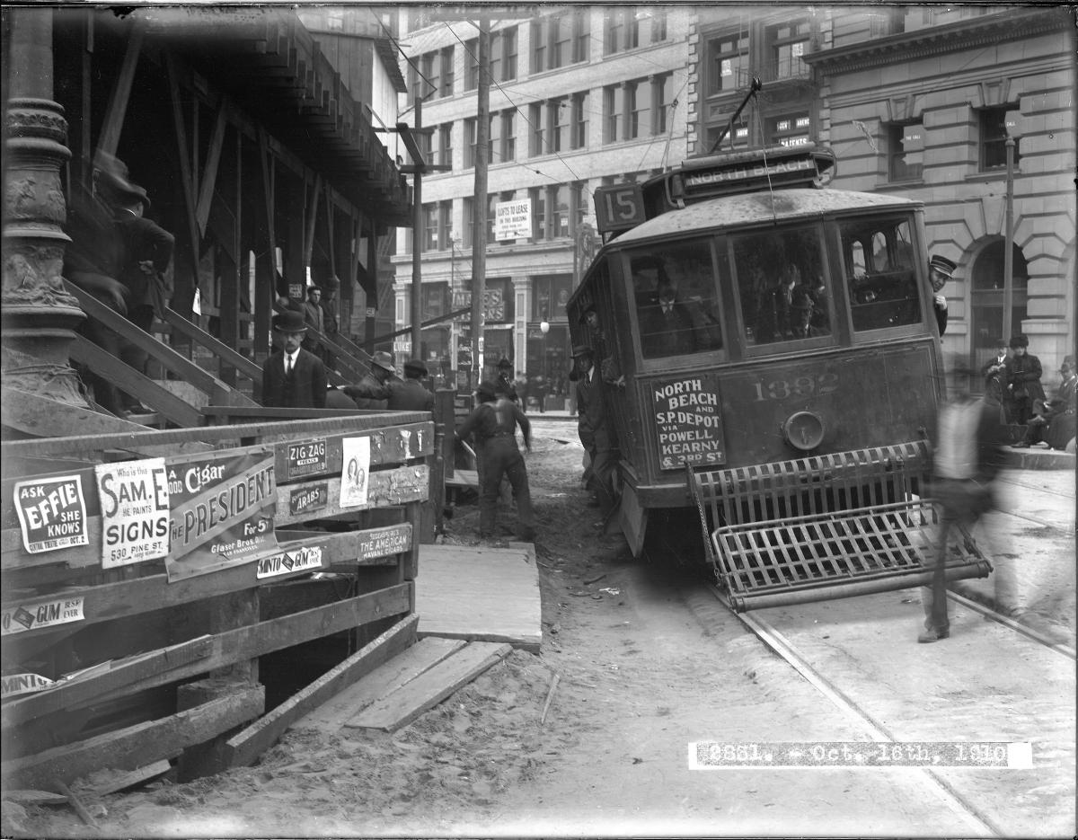
A 15 3rd & Kearny streetcar picks its way through a crowded downtown scene in this 1910 photo.

A 15 3rd & Kearny streetcar picks its way through a crowded downtown scene in this 1910 photo.

In the mid-1800s people began travelling San Francisco’s 3rd Street corridor by stagecoach and horse-drawn streetcars. At the turn of the 20th century, horse car service gave way to electric streetcars, with three lines eventually sharing the work of serving 3rd Street from north to south. Operated by the United Railroads Company, the combined service of the 15 Kearny & North Beach, 16 3rd & Kearny, and 29 3rd & Sansome lines ran from North Beach all the way to the county line in Visitacion Valley.

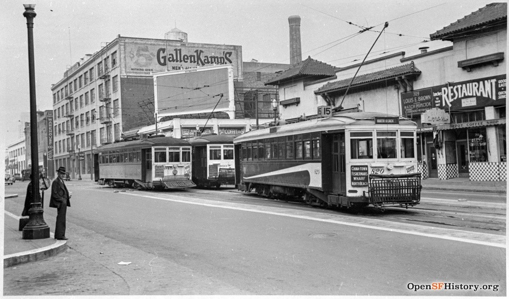
A photo from OpenSFHistory.org showing the 15, 16, and 29 Streetcars outside the Southern Pacific Railroad Depot in 1940, shortly before streetcar service would be replaced with buses.

A photo from OpenSFHistory.org showing the 15, 16, and 29 Streetcars outside the Southern Pacific Railroad Depot in 1940, shortly before streetcar service would be replaced with buses.

In the 1940s, streetcar service was replaced by buses that combined multiple lines into one route.  Like their streetcar predecessors, the buses stopped at key locations along 3rd Street, including the factories in Dogpatch, Southern Pacific Railroad Depot (now 4th & King Caltrain), downtown commercial district, Market Street transit lines and the docks in the North Beach area. 

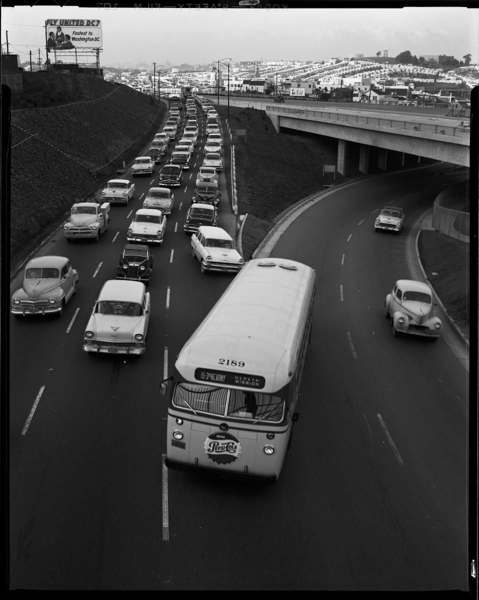
A Muni 15 3rd & Kearny bus makes a lane change on San Bruno & Harkness avenues in this 1957 photo.

A Muni 15 3rd & Kearny bus makes a lane change on San Bruno & Harkness avenues in this 1957 photo.

As the years passed and the city changed, the 15 changed with it, serving different terminals depending on where passengers need to go.  Eventually this expansion led it to become one of Muni’s longest routes, running 11 miles from North Beach all the way to City College. The 15 Third was discontinued in 2007,  after over 60 years of service, when it was replaced by the T Third rail line on Third Street and by a rerouting of the 9x and 9AX routes north of Market Street.

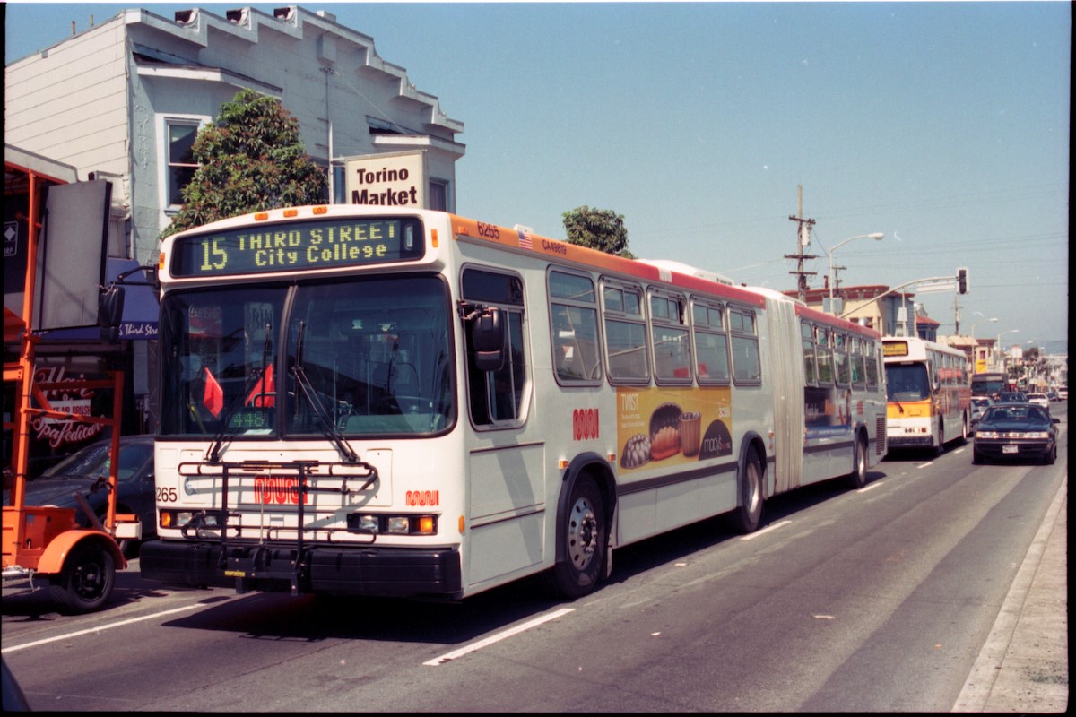
A 15 Third Street coach passes Torino Market at 3rd and Palou on its way out to City College in 2002.

A 15 Third Street coach passes Torino Market at 3rd and Palou on its way out to City College in 2002.

Rapid growth in Mission Bay in recent years has resulted in changing needs for people who travel to and through this corridor. So San Francisco residents began advocating for additional service, particularly through the Southeast Muni Expansion Project in 2018.  Based on public input, that project prioritized a more direct trip to downtown from the Bayview. Responding to these concerns, we established the “new” 15 Bayview Hunters Point Express in January 2021.

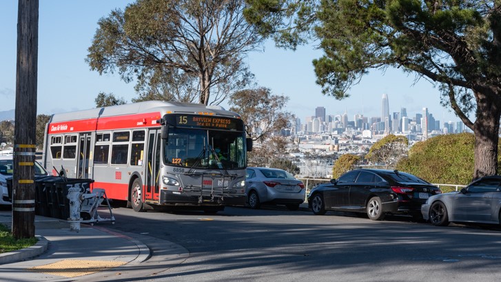
A 15 Bayview Hunters Point Express coach passes a city vista along Jerrold Ave in the Hunter’s Point neighborhood on January 25, 2021.

A 15 Bayview Hunters Point Express coach passes a city vista along Jerrold Ave in the Hunter’s Point neighborhood on January 25, 2021.

Starting out in Hunter’s Point and traveling to the transit hub at 3rd and Palou, the “new” 15 takes riders to locations within the neighborhood and then makes limited express stops to downtown and regional transit connections. The 15 Bayview Hunters Point Express route provides some of the same north-south connections as the original stagecoach and horse car lines back in the mid-1800s.  Just like its predecessors, it builds on a core 3rd Street service and offers a transportation option that seeks to meet the needs of today’s residents. 


Published April 07, 2021 at 10:18PM
https://ift.tt/3t1GUMa

Monday, March 22, 2021

Creating a Better Market Street: Car-free Enforcement to Resume

Creating a Better Market Street: Car-free Enforcement to Resume
By Mariana Maguire

It’s been over a year since Market Street went “car-free” on January 29, 2020, but shortly afterwards, the COVID-19 pandemic shut down our city and changed how people move through San Francisco. As the city begins to reopen and vehicle traffic is increasing, we are by stepping up compliance and enforcement efforts to keep Market Street car-free starting March 29, with the help of SFMTA’s Parking Control Officers (PCOs) and the San Francisco Police Department (SFPD).

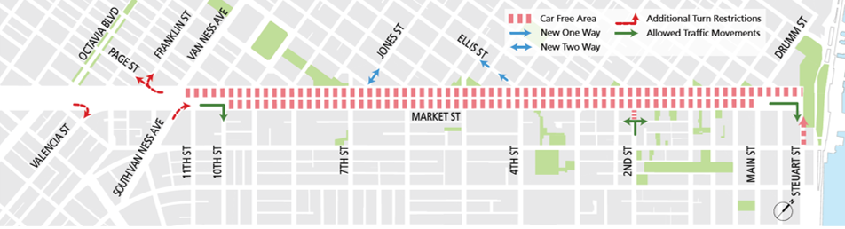
Under the year-old car-free rules established as a part of Better Market Street, no private vehicles are allowed to travel along Market Street eastbound from 10th to Main streets or westbound from Steuart Street to Van Ness Avenue. Traffic is still allowed to cross Market Street, but there are no turns allowed onto the street in the car-free area. These restrictions apply to all private vehicles, including Uber, Lyft, Postmates, DoorDash, and other services whose drivers use personal vehicles without a commercial license plate.

Map of Market Street showing car-free zone from Van Ness Avenue to Main Street eastbountd and from Van Ness Avenue to Steuart Street westbound. New one-way restrictions on Ellis from Market to ____, new two way traffic on Jones from Market to _____, and additional turn restrictions from Market to Valencia street, from Market to Page and Franklin Streets, from South Van Ness onto Market Street and northbound from Steuart to Market. New traffic movements will occur from 2nd Street northbound onto ___ and ____ and on Market Street to Steuart Street.

 Map: Car-free area on Market Street, implemented January 2020.

Enforcement of compliance will increase starting March 29 and will continue for about a month to help remind drivers of the restrictions. PCOs and police officers will monitor the street at various locations. PCOs will wave on vehicles attempting to turn onto Market Street within the restricted area. During the first week of the campaign the SFPD will issue warnings to drivers as we ramp up education efforts. Thereafter, they will issue citations to vehicles in violation of the car-free restrictions.

These efforts are in direct response to violations and concerns we’re heard from people that private vehicles are still driving in the car-free area. We also understand and appreciate concerns around police enforcement and we’re working hand in hand with SFPD to address those concerns.

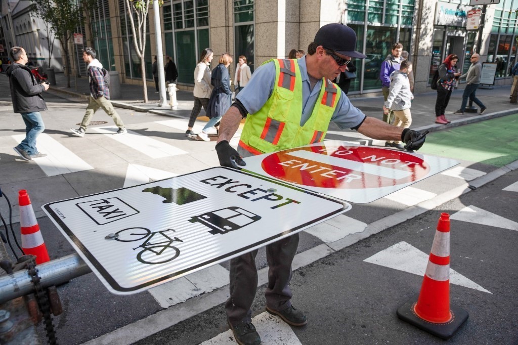
Photo of worker getting ready to put up a pole with new signs indicating that Market Street is restricted to non-private vehicles only.

Photo: Crew member installing new signage on Market Street in January 2020

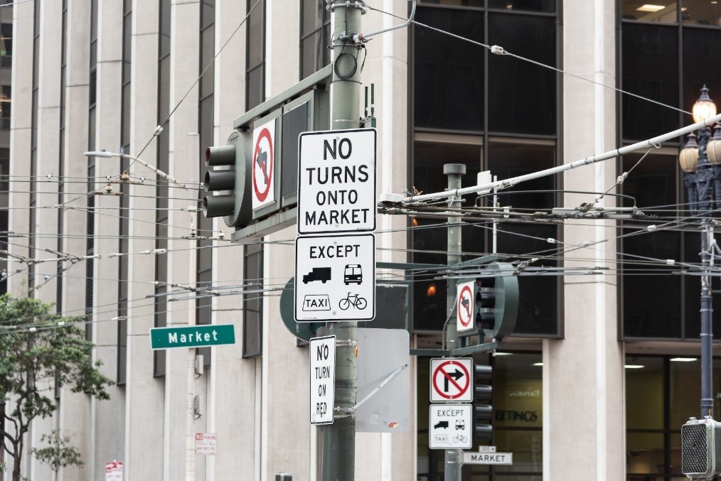
Photo of signs on Market Street indicating restrictions to private vehicles.

Photo: Car-free Market Street signs limiting private vehicles from driving on Market Street east of Van Ness Avenue.

Vehicles that are still allowed to use Market Street:

  • Muni and other transit service vehicles
  • Taxis
  • Paratransit
  • Licensed commercial vehicles
  • Emergency service vehicles
  • Bicycles
  • Scooters

Don’t get ticketed! If you’re not one of the vehicles above, don’t drive on Market Street east of Van Ness Avenue. Pay close attention to signage like those shown in the photos. If you’re using a navigation app it will route you around the car-free area.

Please help us spread the word to family, friends, neighbors and coworkers. Plan your trips accordingly. Consider alternate modes of travel if you’re going downtown. If you need to use your personal vehicle to reach destinations along Market Street, take alternate streets – they’re open!

Keep checking the COVID-19 Muni Core Service Plan website for the latest Muni service as we continue to expand and restore additional Muni rail routes which will improve transit service along Market Street.


Published March 22, 2021 at 08:38PM
https://ift.tt/3f75iIe

Tuesday, March 16, 2021

Muni and SamTrans Partner on Lake Merced Bus Service

Muni and SamTrans Partner on Lake Merced Bus Service
By Enrique Aguilar

Starting March 22, a new program will provide free access to SamTrans Route 122 within San Francisco between Lake Merced Boulevard and Lake Merced Hill. The SFMTA has teamed up with SamTrans to launch this pilot program, which allows residents to sign up to use the 122 while Muni service is limited due to COVID-19.

After applying to the program, customers will be sent an email with a MuniMobile pass link that will be valid for six months. There will be an opportunity to extend the pass if the program is still needed after that, pending the return of Muni’s 57 Parkmerced.

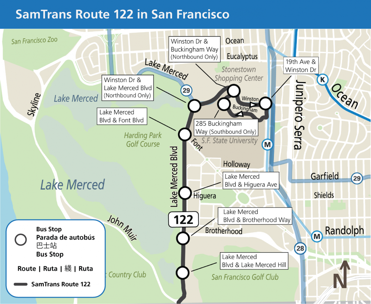
Map entitled SamTrans Route 122 in San Francisco. Eight bus stops are identified: Lake Merced & Lake Merced Hill, Lake Merced Boulevard and Brotherhood Way, Lake Merced Boulevard and Higuera Avenue, Lake Merced Boulevard and Font Boulevard, Winston Drive and Lake Merced Boulevard (northbound only), Winston Drive and Buckingham Way (Northbound only), 19th Avenue and Winston Drive, 285 Buckingham Way (southbound only)

Map of new SamTrans stops in the Lake Merced neighborhood

The SFMTA will post signs at the new bus stop locations and at essential destinations including grocery stores near Stonestown Galleria Shopping Center in order to inform community members about this free pilot program. For more information and to apply, visit the Samtrans Route 122 application page.


Published March 16, 2021 at 08:23PM
https://ift.tt/3cAsfAG

Thursday, March 11, 2021

New Routes to School for In-person Instruction

New Routes to School for In-person Instruction
By Kate McCarthy

As SFUSD considers a return to in-person instruction, many families are adapting how they will travel to school and work and SFMTA is proud to provide a strong set of mobility options to help facilitate school trips. Bicycling, scooting, skateboarding and walking to school have never been more accessible in San Francisco.

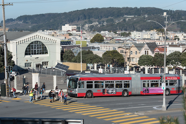
Photo of Presidio Middle school students in crosswalk while bus is stopped nearby

Presidio Middle School

Nearly 30 Slow Streets introduced during the shelter-in-place limit through traffic on certain residential streets with signage and barricades. Slow Streets has significantly expanded the network of low-stress routes families can more safely use to get to schools by walking or bicycling. The SFMTA’s Safe Routes to School team is here to help students get to school safely and sustainably, with resources and trainings on how to walk or bike to school and use the city’s new Slow Streets.

As San Francisco emerges from the pandemic, planning for schools to reopen has been at the forefront of the SFMTA’s Transportation Recovery Plan, our framework for expanding our services and operations as public health orders are modified and demand for travel increases. In 2020, a team led by SFMTA traffic operations engineer Andre Wright evaluated drop-off and pick-up needs at 114 San Francisco Unified School District schools. SFMTA staff are available to assist schools in expanding access to transportation options and safe drop-off planning with our smallest San Francisco residents in mind. 

While we’ve had to make tough choices about Muni service during the pandemic, we have strategically invested in key school routes like the 29 Sunset and 44 O’Shaughnessy and have developed a core network of very frequent service along our major corridors. As school demand kicks-in, the SFMTA  may also reintroduce “school trippers,” the supplemental Muni routes that begin after school hours to serve middle and high schools throughout the city, if needed.

This higher frequency along our core network and extra service on major school routes is complemented by the fact that over 90% of San Franciscans are within a quarter mile of Muni, with even more coverage expected by the time school starts in fall.

To help families take the guesswork out of planning trips, the SFMTA is developing a new Multimodal Transportation map of San Francisco that will launch later this spring. The map combines walking, bicycling and Muni options for getting around. For example, if the Muni route the family used before the pandemic is not in service, they may see an alternate route, or that there’s a slow street or a bike lane in their neighborhood that they may feel comfortable using to get to school.  The Multimodal Transportation map aims to help families navigate travel options and choose the modes that work best for them.

In addition to our work to make sure Muni is ready for back to school, we are proud to be offering our Free Muni for Youth program that provides free Muni to low-income youth ages 5 to 18 living in households making less than the Bay Area Median Income. To help cover Muni fare for students, SFMTA recently partnered with SFUSD to identify 25,000 additional students who would qualify for the Free Muni for Youth program based on their Free/Reduced lunch registration. Letters are being sent to these families that will act as applications that can be signed and returned to sign-up, and an online application will also be available. Anyone who has qualified for the program and received their card is enrolled until they are 19 years old and does not need to reapply.
While taking Muni continues to be a low-risk activity for COVID-19 transmission, the health of Muni customers is a top priority and we are taking extra precautions to limit exposure. Muni car cleaners and station custodians are cleaning and sanitizing vehicles and high-touch surfaces daily with safe, strong disinfectants. We are seeing over 95% mask compliance and families riding Muni to school as the pandemic persists can help by wearing a mask on board and when waiting for Muni.

Whether your family finds a new route to school on two wheels, six wheels, by walking or by rail, we think you’ll find transportation has recovered from the pandemic healthier than it was before. No matter how your family chooses to get to school as in-person instruction reopens, SFMTA is committed to helping you get there.

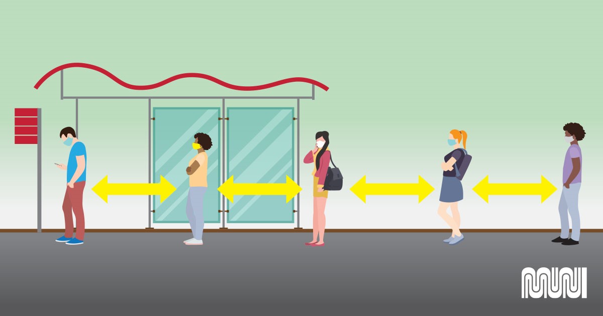
Image of muni patrons standing 6 feet apart while waiting for a bus

Graphic showing physical distancing at Muni stops

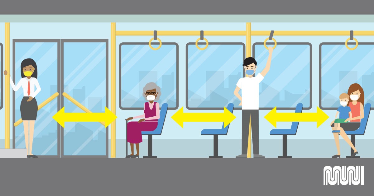
Image of Muni customers riding bus standing 6 feet apart

Example of physical distancing on Muni buses: Wear a mask or face covering and give space for fellow riders.


Published March 11, 2021 at 08:35PM
https://ift.tt/3ezXwGv

Thursday, February 18, 2021

Virtual Parade and New Central Subway Art Ring in Lunar New Year

Virtual Parade and New Central Subway Art Ring in Lunar New Year
By Sophia Scherr

We are entering the year of the Ox, typically symbolizing hard work, positivity, and honesty. This year the SFMTA will continue the tradition of celebration with the virtual San Francisco Chinese New Year Parade  on February 20th at 6 pm on KTVU.

Celebrating Lunar New Year and the San Francisco Chinese community has been a long-standing tradition for many of us. In 1849, San Francisco’s population swelled to 50,000 and many of the new residents were Chinese immigrants, coming to work in gold mines or on railroad lines. By the 1860’s, the Chinese were eager to share their culture with others and the annual tradition of parade and pageantry was born. A variety of other cultural groups throughout the city were invited to participate, and they marched down what today are Grant Avenue and Kearny Street with colorful flags, banners, lanterns, and drums and firecrackers to drive away evil spirits. The city’s Chinese New Year Parade is one of the largest celebrations of its kind in the world, attracting over three million spectators and television viewers throughout the U.S., Canada and Asia.

In line with what the year of the Ox signifies, we also look forward to seeing our work come to fruition when the Central Subway Project's Chinatown - Rose Pak station opens in 2022. As part of this milestone, the SFMTA in partnership with SFAC’s Public Art Program, the Chinese Culture Center, Chinatown Community Development Center, and the Chinese Historical Society have envisioned a vibrant art program for Chinatown’s station. Three significant prominent artworks by artists Tomie Arai, Yumie Hou and Clare Rojas are being installed, infusing the quintessential Chinatown spirit into their works, connecting the past, present and future. These artworks also serve as wayfinding – from marking the entrance to the station, to signaling to riders their arrival at Chinatown with placement of prominent works on the platform walls.

image of Chinese "paper cut" art

Traditional Chinese paper cut artist Yumei Hou developed large murals that will adorn the station

Ongoing community involvement is an essential to ensuring that Chinatown residents had a role in the artwork design process. The Chinese Cultural Center helped convene community meetings so that the artists would be able to meet residents and receive feedback on their proposed designs. Through this support, artists and community members were able to collaborate on the design of the installations. Artist Tomie Arai was able to work with local photographer Bob Hsiang to photograph students from Gordon J. Lau Elementary School who were then featured in her work.

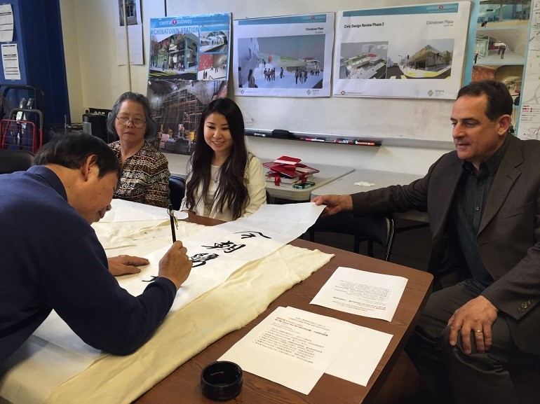
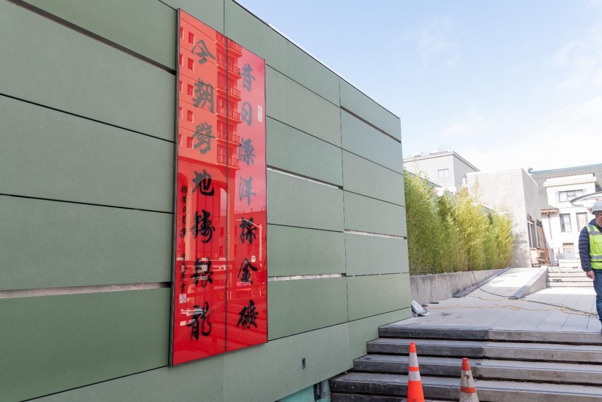
Central Subway Project outreach staff and their partners at the Chinatown Community Development Center wanted to ensure that all aspects of Chinese culture and art were represented in the art program that will adorn the entryway of the stations roof-top plaza. The center conducted a couplet contest that garnered 120 couplet entries from local, national and international poets. San Francisco poet, Carin Mui was selected, her couplet, a form of Chinese poetry with two lines of verse that have a joined meaning and follow a list of exacting rules reads “In the past, we traveled across the Pacific to mine for gold; Now, we break through earth to form a silver dragon.”

Artist Terry Luk paints the winning couplet for the Chinatown Central Subway Station, as composer Carin Mui, former Chinatown Community Development Center staffer Jerri Diep and former Central Subway Program Manager John Funghi look on.

Artist Terry Luk paints the winning couplet for the Chinatown Central Subway Station, as composer Carin Mui, former Chinatown Community Development Center staffer Jerri Diep and former Central Subway Program Manager John Funghi look on.

 The winning couplet was recently installed in the public plaza above the Chinatown – Rose Pak Station

The winning couplet was recently installed in the public plaza above the Chinatown – Rose Pak Station

Public art in our stations is important not only for its aesthetic or beauty, but helps draw out the identity of a space, aids in the understanding of the historic or cultural significance of a neighborhood and builds a connection between visitor and the surrounding community. It’s an important reminder of the power of art to address the complexity and diversity of neighborhoods and to maintain cultural identity in the face of rapid urban transformation.


Published February 18, 2021 at 07:54PM
https://ift.tt/37pAePq

Wednesday, January 27, 2021

Slow Streets: A Path to Permanence

Slow Streets: A Path to Permanence
By Shannon Hake

In locations throughout San Francisco, the Slow Streets Program has shown that minimizing traffic on residential streets allows them to be more safely used as a space for people traveling by foot and by bicycle. Due to the program’s success, the SFMTA is now exploring the possibility of making some of the current temporary Slow Streets permanent, extending their use beyond the COVID-19 emergency.  

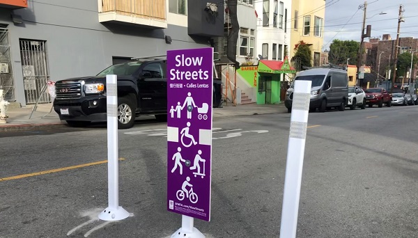
Image of three posts place in the travel lane with a sign indicating "Slow Street" in English, Chinese and Spanish

Slow Streets discourage non-local vehicle access through barricades and signage. Reducing the number of vehicles on Slow Streets provides more space for physically-distanced essential travel and exercise during the COVID-19 emergency. Because of their popularity, community members have indicated a strong interest in a longer-term future for these streets. As such, we are planning ahead so that some Slow Streets can be maintained beyond the public health emergency.

In the coming months we’ll be implementing our “Path to Permanence” on the first three Slow Streets corridors: Page Street, Shotwell Street, and Sanchez Street. These are corridors where our resident and user surveys have shown strong community support for Slow Streets.  The positive feedback from these surveys has shown that residents and users of these Slow Streets overwhelmingly support making them permanent. After completing the planning process with these three streets, we’ll explore other streets in the network using the same process:

  • Determine Support for Permanence: We survey the residents living along all of our Slow Streets to better understand the desire to make the designation permanent. These surveys are ongoing and will be completed on all Slow Streets corridors by May.
  • Listen to the Community: On streets with strong support, we engage with residents and stakeholders on potential permanent treatments. These could include operational changes like turn restrictions or other physical changes with more durable materials, beyond the temporary delineator treatment currently in place on some Slow Streets.
  • Design Permanent Treatments: Using the feedback from the community, our engineers and planners will complete the permanent Slow Streets design, which will consist of uniform elements. We’ll meet with the community again to share this design and address any outstanding concerns.
  • Approve Permanent Changes and Slow Streets Designation: Following a public hearing process and other internal review, we’ll present permanent corridor changes to the SFMTA Board of Directors for final approval.

What’s Next

The SFMTA has implemented 25 temporary Slow Streets since April 2020. Identifying which corridors have support for being made permanent will take time. We plan to survey residents along all temporary Slow Streets corridors by May 2021 to determine which corridors may advance to permanence.

The Slow Streets network continues to evolve, and will expand to include 13 additional temporary corridors if our proposal is approved at the SFMTA Board of Directors meeting on February 16. These new corridors will go through the process outlined above to determine whether they should be considered permanent.

For updates, additional information, and to provide input, visit our Slow Streets Program page. 


Published January 27, 2021 at 07:17PM
https://ift.tt/3t0mPX3

Monday, December 21, 2020

New Muni Route to Serve Bayview and Hunters Point Neighborhoods

New Muni Route to Serve Bayview and Hunters Point Neighborhoods
By Enrique Aguilar

Starting in early 2021, Muni’s new 15 Bayview Hunters Point Express line will improve Downtown access, reduce commute times and add transit capacity for residents of the Bayview and Hunters Point neighborhoods. This community-designed route connects the hilly communities east of Third Street to Downtown and was chosen by residents who voted in a fall 2020 survey. The process and the route demonstrates our commitment to working with communities to provide equitable Muni service. 

Launching the new route coincides with the gradual return of Muni Metro rail service. Returning to rail frees up enough buses to run new service, like the 15 Bayview Hunters Point Express and new 27 Bryant route, and improve frequency on other key routes. Service on the 15 will run every 10 minutes from approximately 5:00 a.m. to 10:00 p.m. weekdays and 8:00 a.m. to 10:00 p.m. on weekends. 

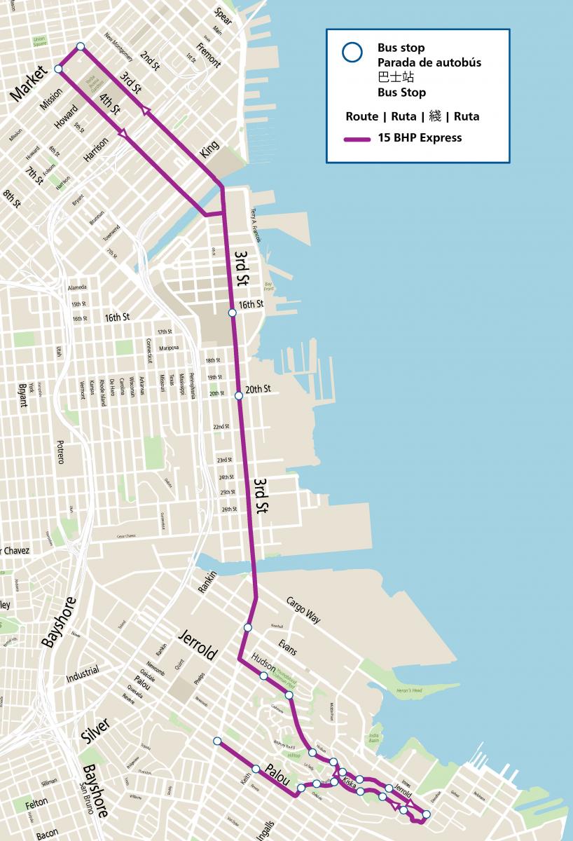
Map of new 15 Bayview Hunters Point Express route, the purple line from Bayview to Downtown shows the new route making stops east of 3rd Street before heading inbound via 3rd Street and on 4th Street in the outbound direction.

Map of new 15 Bayview Hunters Point Express route

The Muni Service Equity Strategy highlights the importance of improving transit performance in neighborhoods with high percentages of low-income households and people of color. The Bayview is San Francisco’s most diverse neighborhood, comprised of 27% African Americans, 37% Asian and Pacific Islanders, 24% Latinx, 12% seniors, 24% youth and over 30% of households having less than $30,000 in annual income. 

The COVID-19 pandemic has hit Southeast neighborhoods the hardest. Prioritizing transportation for those with the fewest options and in an area with a high concentration of essential workers is a critical principle in our Transportation Recovery Plan. Residents often endure long travel times to get to jobs, health care, education and other essential trips whose destination is not within the neighborhood. Addressing long and unreliable travel times is the most consistent request we receive from customers when identifying needed improvements. The 15 Bayview Hunters Point Express directly responds to this feedback by following the community’s lead in identifying the best way to link the Bayview neighborhood to downtown San Francisco.   


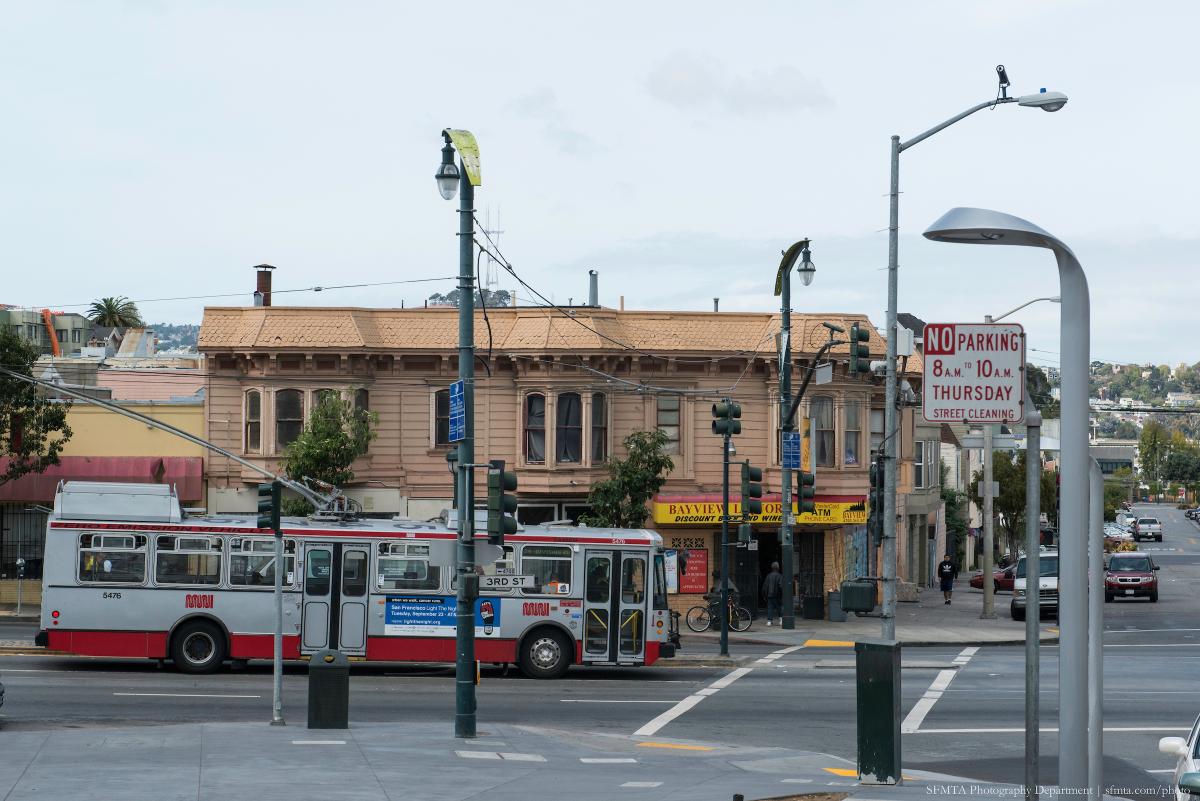
Muni bus on 3rd Street in Bayview 

Muni bus on 3rd Street in Bayview 

Community Collaboration 

The SFMTA has been working in collaboration with residents of the Bayview and Hunters Point community to improve transportation. Last year the SFMTA adopted the Bayview Community Based Transportation Plan, which identifies transportation priorities that reflect community values and support a growing and resilient Bayview.  

In coordination with District 10 Supervisor Shamann Walton’s Office, the SFMTA project team formed a working group comprised of community leaders. In response to COVID-19 physical distancing constraints, the group met virtually and had regular meetings starting in August 2020. The group structure allowed for deep discussions that were critical in identifying key priorities and destinations and provided other important feedback to shape three route alternatives. Those three alternatives were put to a community vote with the preferred option being one that residents felt provided service closer to their homes, made trips shorter and served a part of the community where service is most needed. 

We thank Supervisor Shamann Walton’s office, the working group members and all those whose voted on a preferred route – your voice helped us identify and build this exciting new Muni line to serve the community.  


Published December 21, 2020 at 07:09PM
https://ift.tt/3nH6nrB

Friday, December 18, 2020

By the numbers: Protecting Operator and Customer Health and Safety

By the numbers: Protecting Operator and Customer Health and Safety
By Emily Stefiuk

The SFMTA has responded to COVID-19 by working to minimize the risk of transmission and protect the health and safety of our employees and the public. Health and safety is SFMTA’s Transportation Recovery Plan’s number one priority.  

To assess how we are doing, the SFMTA has been monitoring data through our Transportation Recovery Plan Dashboards. The Objective 1 dashboard compiles metrics associated with health and safety, including sanitizing vehicles and facilities, promoting physical distancing, and encouraging mask compliance. Here’s what we’re seeing:  

  • As of December 6, operator reported mask-related incidents are down 92% from the peak in April.  

  • Mask compliance on Muni is at an all-time high at 96% of observed passengers wearing masks.  

  • We’ve upped our mask distribution – our Transit Information Program (TIP) staff distributed over 14,000 masks to customers the week of November 16.  

  • To date, no COVID-19 positive cases have been traced to riding Muni.  

These findings are even more important as the city and the region have been experiencing a surge in COVID-19 cases after the Thanksgiving holiday. While there is an alarming surge in cases, it's important to recognize that our science-based best practices paired with the public's embrace of critical interventions like wearing a face masks or face coverings allows us to keep our system running for those who need us during this unprecedent time. Additionally, we are maintaining a safe and healthy system so that when increased activity is permitted once again, Muni will be ready for you. 

These numbers reflect efforts that have been underway since the beginning of the pandemic to protect operator and customer health and safety. Since March, SFMTA has implemented mitigation measures that limit the possibility of exposure to, and transmission of, COVID-19. To encourage customers to practice good public health behavior throughout their journey, we launched our Ambassador Program in April and expanded it as the TIP program in September. TIP staff provide information to customers on best practices and alternatives to Muni like our recently-launched Essential Trip Card discount taxi program. TIP staff also provide the public with information about COVID-19 Muni Core Service, help manage crowding and distribute masks to customers that may have forgotten theirs.  

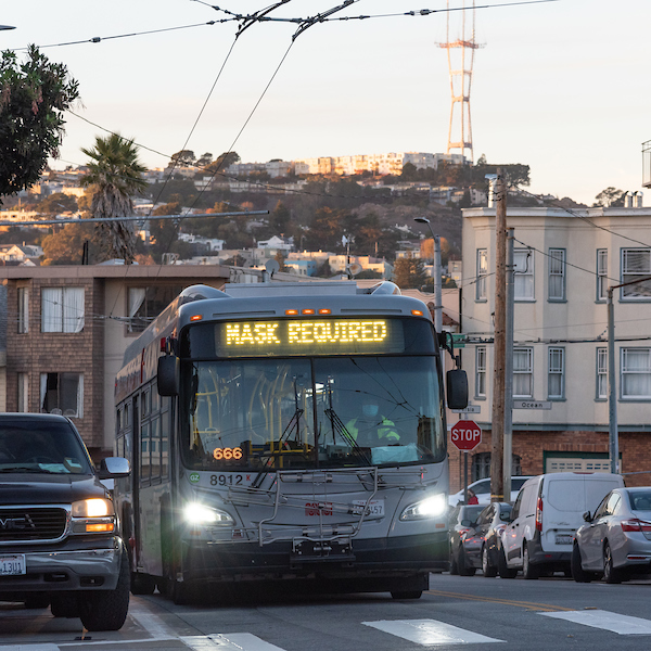
A Muni bus with a "Mask Required" head sign.

Other measures Muni has implemented include audio announcements and head signs on buses to remind customers that masks are required when riding Muni. We have also continued the sanitization practices we implemented at the onset of the pandemic. Vehicles return to our operating divisions at the end of each run, so each operator starts their shift with a sanitized vehicle.  

The metrics show that these measures and added precautions to ensure the health and safety of our employees and the public are paying off. As the pandemic continues, the SFMTA is committed to using data to inform our COVID response, service delivery, and budget decisions.  

Customer Reminders 

Remember, we still need your help. Help reduce the risk of COVID-19 transmission by: 

  • Staying home, except for essential trips.  

  • Shopping locally and supporting your neighborhood businesses. 

  • Wearing a face mask or face covering over your mouth and nose and maintaining physical distance such as leaving a seat open between you and anyone who is not in your household. 

  • Use alternate transportation whenever possible – walk, bike or take a taxi – to save a seat on Muni for those who don’t have other options. 

If you do need to travel on Muni: 

  • Please respect your Muni operator. They are working hard for you. 

  • Face coverings are required on Muni. To avoid getting passed up, cover your nose and mouth with face cover or mask while you are waiting for Muni and on Muni. 

  • Board by the back door unless you require assistance. 

  • Give yourself extra time just in case. Your fare is good for two hours across multiple routes. 


Published December 18, 2020 at 09:00PM
https://ift.tt/2WAatFX

Wednesday, December 16, 2020

Tenderloin Streets Transform During COVID-19

Tenderloin Streets Transform During COVID-19
By Kimberly Leung

COVID-19 has disproportionately impacted people who live and work in the Tenderloin. As a result, the SFMTA has been working closely with District 6 Supervisor Matt Haney’s office, other city departments, the Tenderloin Traffic Safety Task Force and community members to address the public health issues and unique challenges in the neighborhood through innovative interventions.   

The Tenderloin is home to many of our most vulnerable communities including historically marginalized groups such as people with disabilities, residents of SROs and supportive housing and limited-English proficient communities. With every single street in the Tenderloin on the city’s High Injury Network -- the 13 percent of San Francisco streets that account for 75 percent of severe traffic injury collision and fatalities -- this critical neighborhood is the focus of our latest efforts to make the city safer for everyone. 

As part of the city’s COVID-19 response, the SFMTA prioritized changes to Tenderloin streets that aim to achieve immediate and long-term results. Our main priorities, based on community advocacy and feedback, are:  

  1. Expand physical distancing space to alleviate public health concerns around overcrowding  
  2. Support local community group activities and small businesses  

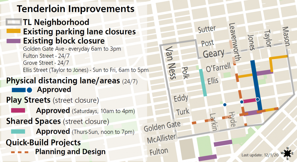
Map showing the Tenderloin, existing parking lane closures shown in yellow - O'Farrell from Mason to Leavenworth, existing block closure shown in purple - Ellis from Jones to Golden Gate, physical distancing lanes in blue - Jones from O'Farrell to Golden Gate, play streets on Turk from Leavenworth to Jones, shared spaces in light blue - on Larkin from O'Farrell to Eddy, quick-build shown with brown dotted line on Golden Gate from Polk to Taylor and Leavenworth from Post to McAllister

SFMTA COVID-19 projects in the Tenderloin: 

  • Parking Lane Prohibitions and Block Closures – Temporary vehicle restrictions were implemented on major blocks in the neighborhood to support essential services like safe sleeping sites, physical distancing and meal services. This includes daily street closures on the 100 block of Golden Gate at St. Anthony’s and the 300 block of Ellis (except Saturday) in collaboration with GLIDE to provide the community with free meals programs. These closures have allowed the blocks to transform into vibrant, community spaces where residents and workers can receive COVID-19 testing, visit pop-up food pantries, take showers, get meals, and simply have outdoor space. 
  • Outdoor Dining (Temporarily paused for our current Health Order) – The city’s Shared Spaces program is a vital lifeline for businesses by creating flexible uses of sidewalks, streets and outdoor spaces for restaurant and retail activities. In the Tenderloin, the program facilitated temporary closures on Larkin Street between Eddy and O’Farrell streets and previously parts of Golden Gate Avenue for Tenderloin restaurants and retail.  
  • Play Streets – Through partnerships with the Boys & Girls Club, Tenderloin Community Benefit District and other community-based organizations, a weekly closure of Taylor Street between Leavenworth and Jones streets provides temporary car-free open space for children, seniors and Tenderloin neighbors to enjoy every Saturday. Play Streets have been successful in creating a space for children to play, for COVID-19 testing and resources and for neighbors to take a break outside.  
  • Jones Street Physical Distancing Lanes – Between Golden Gate Avenue and O’Farrell Street, a lane was established to provide temporary walking and rolling space on a critical north-south connection in the neighborhood. The eastern parking lane and one vehicle lane on Jones Street were repurposed to provide this pedestrian walking space -- doubling the width of the sidewalk. 
  • Turk Street Physical Distancing Zones – The sidewalks on Turk Street, a key east-west corridor in the neighborhood, have been expanded at intersections with high pedestrian volumes, including Jones, Leavenworth and Hyde streets so that people could physically distance themselves while waiting to cross the intersection. 

Upcoming Projects:  

  • Golden Gate and Leavenworth Vision Zero Quick-Builds - The project goal of the Quick-Builds is to improve overall comfort and safety for those walking and bicycling on Golden Gate Avenue between Market and Polk streets and on Leavenworth Street between McAllister and Post streets. Please join us for the Virtual Open House for the Golden Gate and Leavenworth Quick-Build projects from December 15th through January 8th. The Virtual Open House will be hosted in seven languages reflecting the diversity of the community.  
  • Tenderloin Neighborhood Traffic Safety Improvements - Building on past comprehensive neighborhood-wide efforts in the Tenderloin, including daylighting and signal retiming, we are proposing to reduce the neighborhood speed limit and implement “no turn on red” regulations. Studies show that lowering speeds greatly improves a pedestrian’s chance of survival in the event of a collision. Currently, most Tenderloin streets are 25 miles per hour, and now, the SFMTA is proposing to lower the neighborhood speed limit to 20 miles per hour. If approved, the Tenderloin will be the first neighborhood in San Francisco to have widespread speed reductions. 

Thank You Tenderloin Community! 

We want to express sincere appreciation and acknowledge the Tenderloin community groups who have been tenacious in advocating for traffic safety and travel options in their neighborhood: Tenderloin Traffic Safety Task Force, Tenderloin People’s Congress, Tenderloin Community Benefit District, Central City SRO Collaborative, Tenderloin Neighborhood Development Corporation and many others. We are committed to being responsive and partnering with the community as we work through this crisis together.   


Published December 16, 2020 at 07:56PM
https://ift.tt/2Kyk51e